| cocoahigh65.com Hurricane Katrina: The Storm That Changed A Nation |

Images of A Calamity
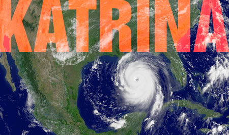
6 a.m., August 29, 2005: Hurricane Katrina comes ashore for the second time, after first striking southeast Florida the previous week. It’s target: Louisiana’s Plaquemines Parish. The results are disasterous for the coastal village of Buras and her neighbors along Highway 23 that parrallels the Mississippi southeast through the marshes into the Gulf. These were among the first, but by no means the last, victims of the storm’s furious assault on the Southeastern United States.
|
||
| Got a story to tell? Pix to share? Send ’em along, and we’ll figure out how to get them in print. |
GOVERNMENT
My friend Chris Reid is a botanist with the
Louisiana Department of Wildlife and Fisheries Natural Heritage Program. He sent this Plaquemines Parish slide show of aerial and ground views of where the category four storm came ashore the second time. Taking deadly aim on Buras, the towns flanking both sides of this coastal village up and down Highway 23 are wiped out. PDF
NOAA’s Katrina site offers post-storm aerials of the affected regions. This is not satellite imagery, but high resolution images taken from relatively low altitude jets several days after the storm had passed.
NASA’s Katrina reporting includes this page of before and after satellite images. High resolution imagery provides in-depth detail.
 Remember Indiana Jones’ line in Raiders of the Lost Ark, “I hate snakes!” If you’re like Indy, please don’t look at this page from NIOSH, the National
Institute for Occupational Safety and Health, of a September 9th rig inspection.
MEDIA
This Biloxi Sun Ledger slide show contains amazing aerials along (what used to be) scenic US 90. Although the world’s attention is focused on New Orleans, virtually the entire northern Gulf Coast has suffered enormous damage from wind, rain, and tide as a result of the hurricanes of 2004 forward.
NOLA.com is where the Times Picyune’s set up shop as an online paper. Great source for local flavor and regional views.
The Baton Rouge Advocate is another great source for news and information concerning the recovery. This site has done an amazing job since before the storm hit in keeping the site up and running despite power outages throughout the region.
OTHER
A compiled Acrobat tour of Biloxi along U.S. 90, with explanations of what used to be where but now can’t be found. Perhaps the best illustration of the hydraulic power of wind-driven waves. PDF
Katrina info map from sciopionus.com. This unusual site posts interactive comments as map pushpins, allowing viewers to understand the level of devastation throughout the tri-state region.